
The Manaslu region, in the northern part of the Gorkha district in Nepal, has been designated as a Conservation Area since 1998. During the trek, visitors enjoy natural scenery and Himalayan views, including Manaslu I (8,163 metres), the world’s eighth-highest mountain. The trek also includes suspension bridges, mountain villages, and sunrise views from Syala.
The Manaslu region features glacial lakes, Buddhist monasteries, and rare wildlife. Trekkers can visit Mu Gompa and Rachen Gompa to observe daily rituals and learn about Tibetan Buddhist traditions. They may encounter blue sheep, Himalayan Thar, Himalayan serow, and marmots, while birdwatchers can observe snow partridge, Tibetan Snowcock, Himalayan griffon, and golden eagle in alpine areas.
The Manaslu Circuit trek lasts 13 to 16 days and includes difficult high-altitude terrain. The trek begins in the Budhi Gandaki valley, crosses the Larkya La pass (5,160m), and finishes in Dharapani in the Manang district. Because the route is demanding, you need a good level of fitness and previous trekking experience. Some sections go above 5,000 metres, so trekkers must be aware of the risk of altitude sickness. Climb gradually, stay well hydrated, and give yourself enough time to acclimatise. Take a basic first-aid kit and talk to your guide or a medical professional about altitude safety before you go.
Trekkers must obtain a restricted area permit as well as permits for both the Manaslu Conservation Area and the Annapurna Conservation Area, since these are checked during the journey. All trekkers in the Manaslu area must hire a licensed guide, and most tourists also hire a porter to carry their luggage. While most trekkers stay in local teahouses with basic rooms and meals, camping is possible in certain areas.
| MCA FACT SHEET: | ||
| MCA declared: | 1998. | |
| Total Area: | 1663sq. km. | |
| Major Ethnic Group: | Chhetri, Brahmin, Magar, Gurung, and Tibetan. | |
| The highest peak: | Manaslu I (8163m). | |
| Major Destinations: | Chhokang Paro, Mu Gomba, Sama Gaon, Pengyen Gomba, Manaslu Base Camp, and Samdo village. | |
| Trekking to the highest elevation: | Larkya La 5160m pass. | |
| Lakes: | Kal Tal, Birendra Tal, and Ponkar Tal. | |
| Bioclimatic zone: | Sub-tropical to Nival. | |
| Economy: | Agriculture, Animal Husbandry, Seasonal Migration (Trade and Labour), Tourism, and Service in the Army. | |
| Plants: | 2000. | |
| Mammals: | 39. | |
| Birds: | 201. | |
| Reptiles: | 3. | |
| Butterflies: | 11. | |
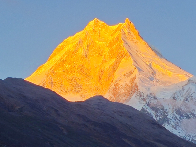
On the Manaslu Circuit Trek, you follow old Himalayan trails. During the trek, you experience Buddhist cultures and enjoy local hospitality. Additionally, you view the Manaslu, Ganesh Himal, Sringi Himal, and Annapurna ranges. This trek combines culture, mountain scenery, and a worthwhile physical challenge. The Manaslu Circuit is a classic trek on the Nepal Great […]
view details